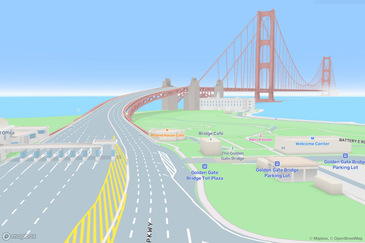
Introducing Mapbox 3D Live Navigation
3D lane-level road models, live vehicle detections, landmark buildings, and realistic vegetation adds detail and clarity to navigation experiences

Today, Mapbox introduces Mapbox 3D Live Navigation, offering drivers an accurate and visually stunning navigation experience by combining 3D lane models, real-time sensor information, sign data, environmental models, 3D landmark buildings, dynamic lighting conditions and weather. Where conventional maps offer low resolution map data with road centerlines and flat two dimensional polygons to represent the map, Mapbox 3D Live Navigation utilizes high-resolution geometries, texturing, lighting, and real-time sensor data to create a more comprehensive and useful experience.

Integrated lane level navigation and live sensor information
Mapbox 3D Live Navigation uses Mapbox data, generated by feedback data from millions of vehicles and aerial imagery, to create a comprehensive 3D world. It integrates with in-vehicle sensors to understand the vehicle's precise location on a multilane road and augment the map with other vehicles and Advanced Driver Assistance System (ADAS) hazard warnings. This provides drivers with lane-level instructions, signpost information and better situational awareness, allowing them to navigate complex intersections and multilane highways safely and with ease. Additionally, the 3D detail helps to locate building entrances and identify parking and charging locations, reducing the time drivers need to reach their destination.
“With Mapbox 3D Live Navigation, we are truly leveraging the sensor harness of the next generation of connected cars. The solution incorporates both sensor-enhanced map data at scale and real-time sensor readings for clarity and visual appeal. As a result, the navigation experience maximizes the clarity of maneuver instructions and helps find charging locations, parking and building entrances quicker."
Peter Sirota, CEO, Mapbox


Mapbox 3D Live Navigation merges ADAS and Navigation into a single view instead of contextless display of detections in traditional ADAS systems
Dynamic Weather & Lighting Conditions
Alerts for weather are integrated and provide drivers heads-up notifications of changing conditions. Mapbox 3D Live Navigation integrates dynamic atmospheric and lighting conditions providing a navigation experience that mirrors the actual physical surroundings of a vehicle.


Location-dependent sun angles, scene lighting, and shadow angles are true to actual local conditions, providing an additional visual orientation cue. These advanced rendering features are integrated with a carefully chosen level of detail for instant legibility and reduced visual context-switching for drivers ensuring an information-rich visual experience while eliminating distractions.


Detailed maps for parking and charging
Mapbox high-resolution 3D models for major landmarks and buildings help improve map orientation, and increase the level of visual details for better mapping of entrances, parking, and charging locations. Mapbox 3D Live Navigation simplifies EV charging by combining high precision EV chargepoint data with navigation on parking aisle level to get drivers to charging stations hassle-free. The 3D map helps drivers find charge points that are tucked away in the corners of parking lots and garages, with a detailed display that clearly marks availability and integrated payment options.
Get started
Mapbox Live 3D Navigation is now available in private preview. Contact us to learn more.


%20(1).png)
.png)